• Homepage
  • Industry
    • GIS surveying
    • Greenery and environmental protection
    • Hydrogeology
  • About the app
    • Map
    • Surveying
    • Projects
    • Fieldwork
    • References
  • Download
  • Help
    • Manuals
    • Tutorials
    • FAQ
  • Blog
  • Contact
  • Polish
Aplikacja tMap
  • Homepage
  • Industry
    • GIS surveying
    • Greenery and environmental protection
    • Hydrogeology
  • About the app
    • Map
    • Surveying
    • Projects
    • Fieldwork
    • References
  • Download
  • Help
    • Manuals
    • Tutorials
    • FAQ
  • Blog
  • Contact
  • Polish
Obraz

your way
to FIELD work 

Professional mobile GIS in your smartphon
Download the tMap trial version
Obraz
Obraz
References

News

What's new in application?

Picture
New functionality:
​import and export of term lists
Since autumn 2017, tMap app users can enjoy a new functionality enabling them to
​ import and export term lists...
more
Picture
tMap for vegetation inventory and surveying
tMap operates on projects. They enable you to define maps and surveying layers...
more
Obraz
tMap is compatible with the Geode submeter receiver! 
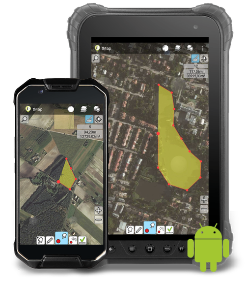
Surveys are the essence of field work. Hence, it was crucial for us to enable performing them with appropriate accuracy...
more
older news
Wspierane przez Stwórz własną unikalną stronę internetową przy użyciu konfigurowalnych szablonów.
  • Homepage
  • Industry
    • GIS surveying
    • Greenery and environmental protection
    • Hydrogeology
  • About the app
    • Map
    • Surveying
    • Projects
    • Fieldwork
    • References
  • Download
  • Help
    • Manuals
    • Tutorials
    • FAQ
  • Blog
  • Contact
  • Polish